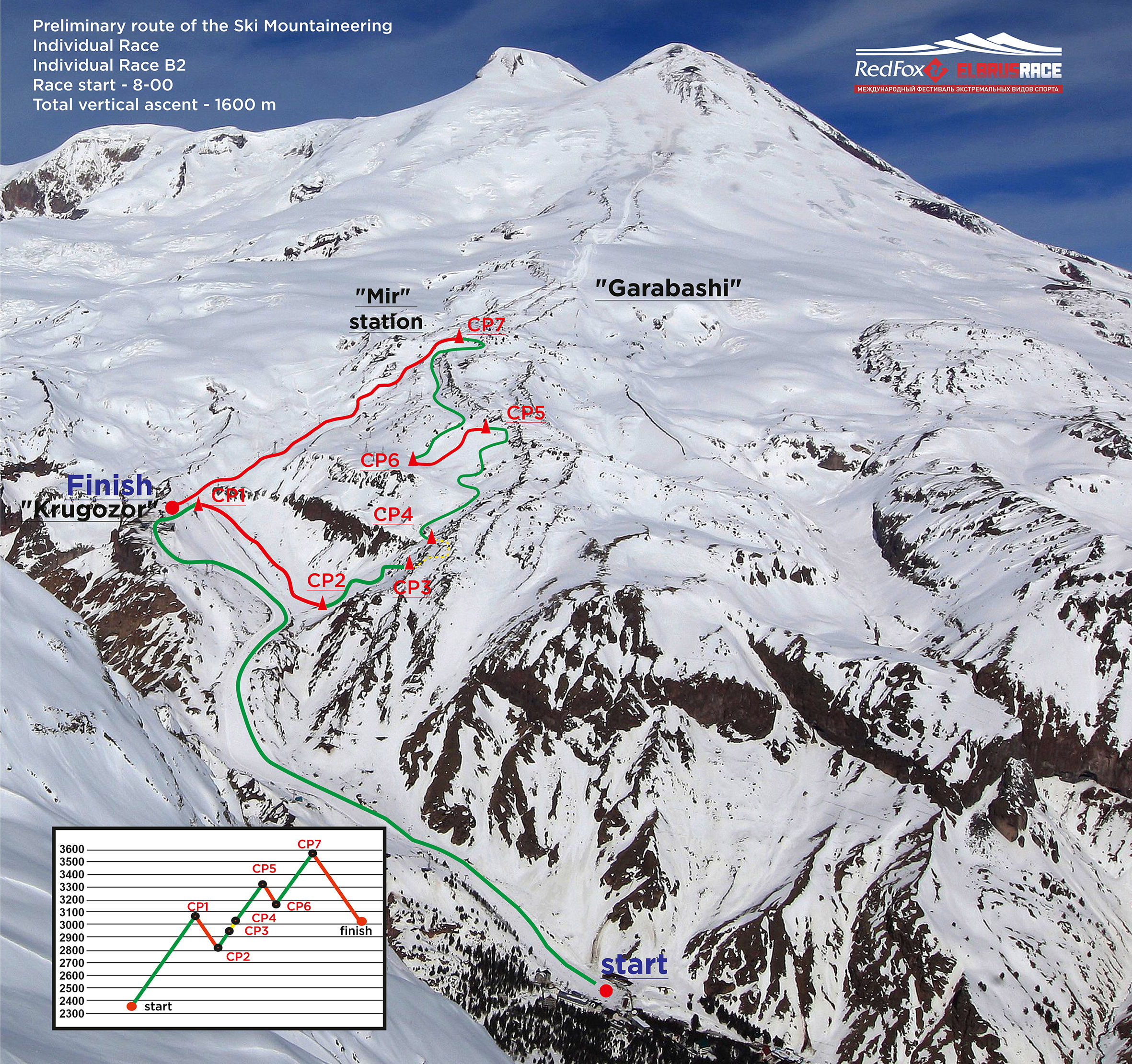
ROUTE
SKI MOUNTAINEERING INDIVIDUAL RACE
Route
Individual passage of the distance, with a change in direction of movement and way of movement.
1. Total vertical ascents - from 1600 up to 1900 meters.
2. Ascents - not less than 3 pcs., спуски - not less than 3 pcs.
3. Quantity of control points at distance - not less than 6 pcs.
4. Trekking section - не менее 1 piece.
The race will take place on the slopes between 2500 and 4500 meters.
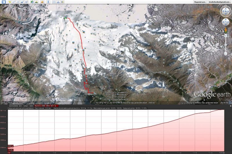
SAMPle OF ROUTE OF THE SKI MOUNTAINEERING INDIVIDUAL RACE
VERTICAL KILOMETER® - MT. ELBRUS
Azau Glade (2450 m) – «Mir» Station (3450 m)
The Vertical Kilometer is a classical discipline in Skyrunning. It is defined by an elevation gain of 1000 m over a distance, not exceeding 5000 m in length.
Participation in the Vertical Kilometer® is obligatory for qualification of competitors for the speed races up to the summit of Mt. Elbrus: SkyMarathon® - Mt. Elbrus and Skyrace® - Mt. Elbrus.
The race is hold between Azau glade and "Mir" station.
Route of the Vertical Kilometer® - Mt. Elbrus, 2450-3450 m
SKYMARATHON® - MT. ELBRUS / SKYRACE® - MT. ELBRUS
Speed-race to Elbrus Western summit in two different categories:
- «Sport» - SkyMarathon® - Mt. Elbrus, 2350-5642 m, international skyrunning competition, marathon.
Distance of tge race: Azau (2350 m) - "Mir" station (3450 m) - «Barrels» (3780 m) - Patukhov Rocks (4800 m) - Elbrus saddle (5350 m) - Elbrus Western Summit (5642 m).
Route profile of the SkyMarathon® - Mt. Elbrus, 2350-5642 m
You can download the GPS track of route from the link below.
- «Classic»: - Skyrace® - Mt. Elbrus, 3780-5642 m. Distance of the race: «Barrels» (3780 m) - Patukhov Rocks (4800 m) - Elbrus saddle (5350 m) – Elbrus Western Summit (5642 m).
Skyrace® - Mt. Elbrus, 3780-5642 m
Download (SWF, 1,6 mb)
Route of the SkyMarathon® - Mt. Elbrus, 2350-5642 m